
The Hacker’s Guide to Toronto’s Ravines
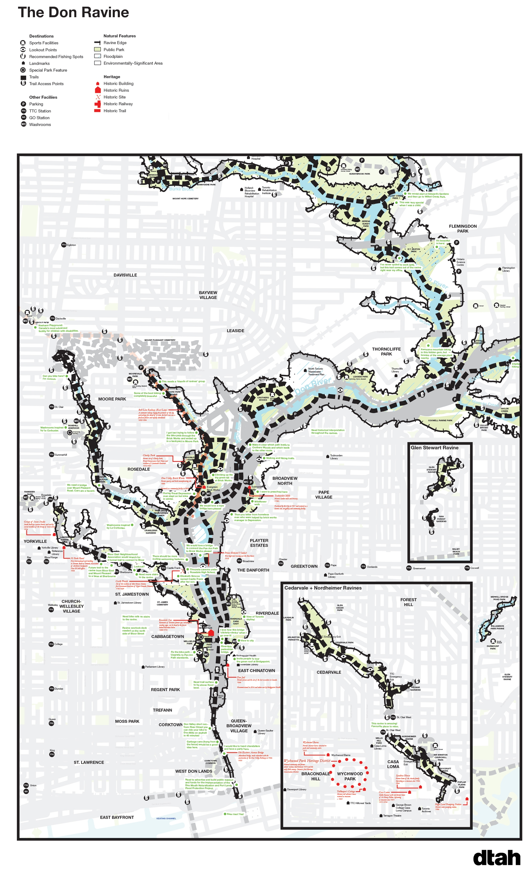
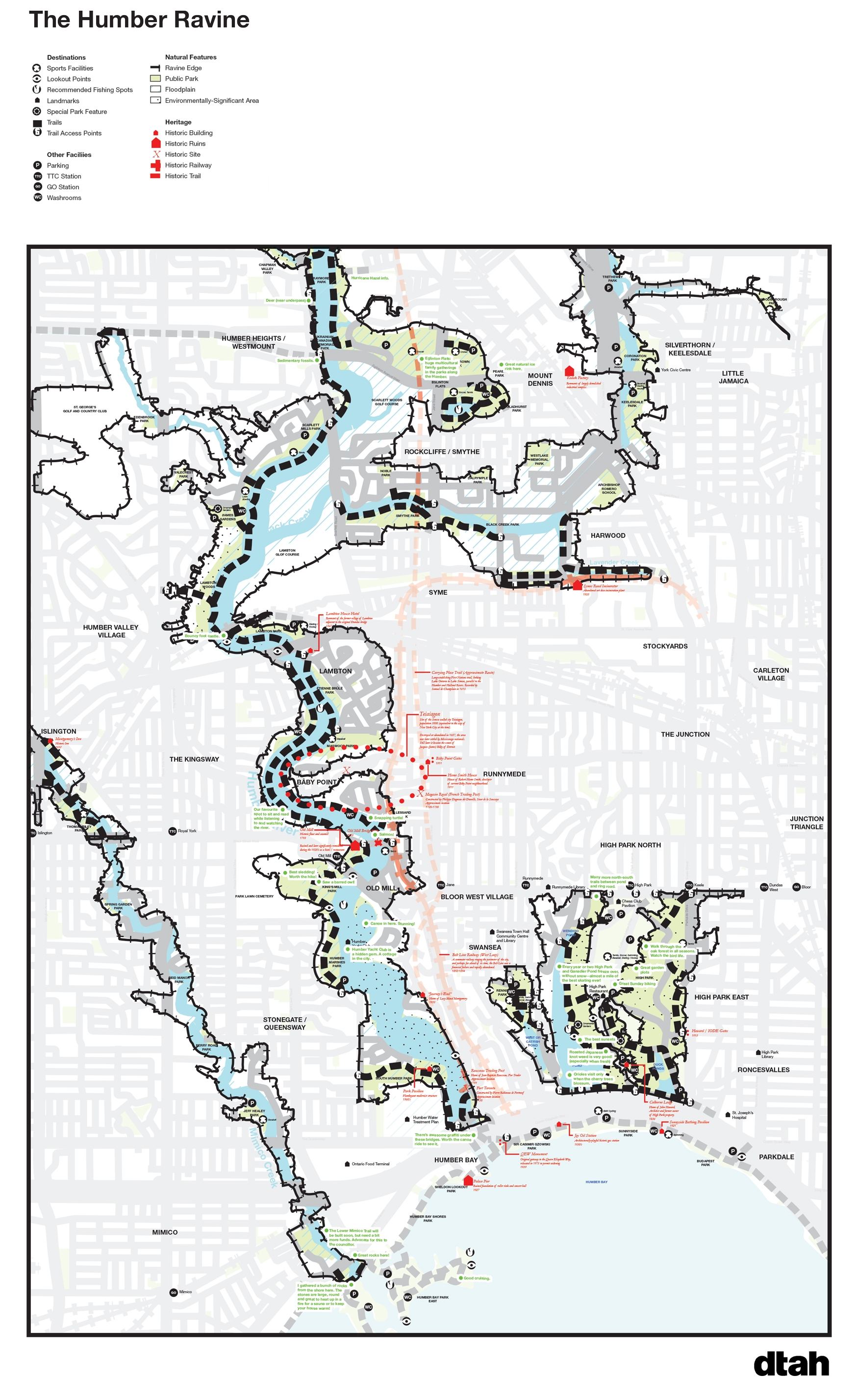
Image: Overview of Hacker’s Guide to the Don Valley Ravine. (DTAH)In 2014, as part of the RavinePortal Exhibition, DTAH published two Hacker’s Guides to the Ravines: one focusing on the Don Valley ravine system, and the other on the Humber Valley.
These guides featured comprehensive maps of each ravine system, layered with relevant information pertaining to access, use, programs, amenities, key features and points of interest. The guides were enhanced by the community - as people shared anecdotes, tips and tricks about the ravines as part of the RavinePortal Exhibition - and this information was incorporated into the maps.
Since the RavinePortal Exhibition closed, and these maps were produced, DTAH has had the great fortune to continue working extensively with the City of Toronto to implement accessibility and safety improvements in the Don Valley, as part of the Lower Don Trail Master Plan Implementation, including widening trails, introducing bridges and new pedestrian and cyclist access points, and incorporating local and Indigenous artworks into the trails. These improvements ensure the Lower Don is safer and more accessible in all seasons.
As the Covid-19 pandemic continues, accessing outdoor space has never been more crucial to our collective mental and physical health. Exploring Toronto’s ravines is a great way to get outdoors and learn more about your City!
In this spirit we’re again making these guides available for download below. We’re always interested to hear peoples’ experiences of the ravines. If you have a tip that should be included on the maps, let us know
2014 Humber Valley Ravines Guide
PDF Versions of Guides [Opens Google Drive]
Related Projects

